SDR-DVB-navale
Ricezione del traffico navale tramite radio SDR con il DVB-T RTL820T
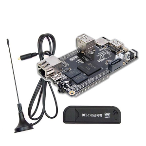
Utilizzo di un'antenna efficace
Oltre alla corretta installazione e compilazione dei programmi, non dimenticatevi di utilizzare una buona antenna di ricezione!
Il programma GNU AIS
GNU AIS - Automatic Identification System per Linux. questo programma contiene gli algoritmi necessari a demodulare e decodificare i messaggi AIS inviati dalle navi e dalle stazioni costiere. Richiede l'installazione e la connessione di un discriminatore di uscita su un ricevitore VHF al fine di ottenere un funzionamento regolare.
Il codice sorgente di gnuais viene mantenuto su Github. Potete scaricare clonando il suo repository con il seguente comando da terminale:
git clone https://github.com/rubund/gnuais.git
Se siete utenti con SO Ubuntu, potete aggiungere il PPA ppa:saltmakrell/gnuais con i seguenti comandi:
sudo add-apt-repository ppa:saltmakrell/gnuais
sudo apt-get update
and then you can easily install gnuais with
sudo apt-get install gnuais
o attraverso l'Ubuntu Software Center che manterrà aggiornato il programma ogni volta che verranno trovati aggiornamenti disponibili.
Potete anche installare l'interfaccia grafica GUI, con il seguente comando:
sudo apt-get install gnuaisgui
(ricordatevi di avere l'applicazione gnuais avviata in background prima di avviare l'iterfaccia grafica).
Sorgente in tar.gz: Scarica
Nella figura seguente, vengono raffigurati tre diversi tipi di pacchetto dati, tipo 1, tipo 4 e tipo 5.
Il tipo 4 sono pacchetti che sono stati inviati dalle stazioni base a terra verso i natanti. Normalmente vengono inviati a intervalli regolari senza interruzione. Il primo numero, 002573325 è il MMSI. Questo è un ID unico che identifica la stazione base. I numeri 0 0 0 24 60 60, sono preceduti dalla data e l'ora, ma sembrano simili a quelli delle stazioni base che che non hanno l'orario o altri dati corretti. Gli ultimi due numeri sono la latitudine e la longitudine.
Per il messaggio tipo 1, the first number is the MMSI, the two next numbers are latitude and longitude. Then there is a number which is heading in degrees. 220 means that the ship is heading south-west. 0 degrees is north. The next number is speed in knots. For ships you can check up the MMSI at http://www.itu.int/cgi-bin/htsh/mars/ship_search.sh and find out some extra data about it. For example is the one with MMSI 565427000 called ARWEN and a Singapore based ship.
Il software è capace di decodificare i pacchetti che abbiano il nome e i dati di destinazione presenti, ma questi dati sono molto lunghi e se la ricezione non è molto buona e/o la trasmittente è molto lontana, alcuni di questi dati vengono decodificati con qualche errore. Those packets are of type 5, and if you are lucky you will get some of them decoded too. Below there is one type 5 packet which says that the ship with MMSI 257347700 is called LISE and is heading for Trondheim, it is 15 meters long, 4 meters wide and the height is 1.5 meters.
If you have a computer running mysql or access to a mysql-server elsewhere you can configure GNU AIS to save data to this server. Then you will be able to query information about ships with other software. You can for example make queries which provide detailed info about where and when a ship have been, what speed it had etc. You can also make software which makes the MySQL data available for Google Earth. Then you can get a graphical view of the ships and boats sailing in your area.
If you are interested in GNU Radio, you will find a GNU Radio version of AIS decoding and demodulating at: http://funwithelectronics.com/sdr/ais.php
